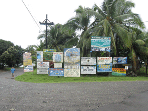
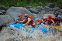
The first time I went to Puerto Jimenez was back in the mid 1970, and it took us about three days traveling on very pot-hole ridden, one-lane dirt road. And thinking back, I think we were heading to Panama or Golfito, made a right instead of going straight at Chacarita, and ended in this very remote town. About the only Gringos we saw were surfers who were headed to Cabo Matapalo, a small town … [Read more...]
Golfito, Banana Republic and Ecotourism of Golfo Duce, Costa Rica
07/11/2010 by 3 Comments
These days, the words Banana Republic are more likely to conjure up an image of neatly stacked chinos and v-neck sweaters than they are a place like Golfito. But when United Fruit built this town on the southwest coast of Costa Rica in 1939, there was nothing here but wilderness and Boruca, the region's indigenous tribe. Fleeing a rash of banana disease. like what happened to Quepos, that … [Read more...]
Mild to Moderate Earthquake Hits Near Golfito
09/06/2009 by Leave a Comment
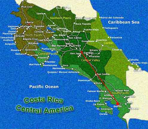
An mild to moderate earthquake estimated at 4.5 magnitude took place at 11:02:46, Saturday on 9.5.09 in Costa Rica. According to the U.S. National Earthquake Center said the epicenter was about 5 miles east and north of Golfito in the southern end of the Puntarenas Region of Costa Rica. This is the second earthquake to hit the southern zone. On March 11 of this year, one registered 6.3 on … [Read more...]
Costa Rica’s Coronado – Wellness, Development, Airport
08/12/2009 by 1 Comment

Not to be confused with the mountainous region north of San Jose, about half way between the Pacific side cities of Uvita (South of the Dominical) and Puerto Cortes, lies the growth-targeted natural wonderland of another, Coronado. While tourist and retirees were flocking to Costa Rica's northern Pacific Coast which has been perceived as the country's first hot spot, further South (about 240 … [Read more...]
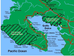
Golfito – Costa Rica’s Ecotourism & Sportfishing
04/27/2009 by Leave a Comment
The first time I heard of Golfito, I thought it was some golf resort - not a sport that many (if any at all) Costa Rican's knew about. Golfito, literally meaning, "little bay" in Spanish, is referred to as the last frontier. It is considered a remote and secluded region of the country, Southern Pacific portion of the province of Puntarenas that’s separated from the open Pacific Coast by the … [Read more...]
Costa Rica Custom Travel and Vacation Package
03/23/2009 by 2 Comments
I usually do not like to hype a single travel agency in Costa Rica, because there are so many that provide excellent services, like the ones in our directory. However, due to the increasing S & Ss (scammers and spammers) bad trips I've read about on many chat rooms and blogs, I thought I’d write about one person that provides the Royals Royce treatment. If you want to be pampered, spend … [Read more...]


Comments